It often happens that parents reduce their preschooler’s acquaintance with geography to only studying maps, memorizing state capitals and memorizing flags. But geography is very vast, has many sections and touches almost every aspect of our lives. This is not only a geographical map...
The concept of geography also includes meteorology, ethnography, geology, ecology, local history, geodesy, geophysics, tectonics and many other related sciences. And this is perhaps the most interesting area of knowledge for a child. After all, any little person is very interested in the structure of the world around him. He is concerned about travel and distant countries, the people and animals that live there. He asks many questions about why earthquakes happen and volcanoes erupt, why the sea always rolls waves onto the shore and why the water in it is salty, what is located underground and at the bottom of the ocean...
Our home is Earth
The baby's first ideas about himself and the world around him are usually very fragmented and unsystematic. Our task as parents is to help the baby realize that every person (including the baby himself) is part of this world. Where to start? First of all, introduce your baby to our amazing planet. Your story might sound something like this: “Every person has his own home. You have it too. You live in it with mom and dad. But all, all people have one more big common home - our beautiful planet Earth. The sky is like a huge blue ceiling, and the ground we walk on is the floor. One big sun shines for everyone. The rain pours on us, like a shower, and the breeze blows across us. A long time ago, many, many years ago, people knew nothing at all about our planet. They thought that the Earth was like a big pancake and lay on the backs of three whales or three elephants, which stood on a giant turtle. When animals began to move, earthquakes occurred on Earth.” Together with your child, you can draw these elephants, and the turtle, and the Earth on their backs and laugh together, because anyone, even the smallest child, knows very well that the Earth is not a pancake, but a huge ball. Of course, a globe will be very useful to you. After all, only with its help will the baby be able to at least slightly imagine what our planet really looks like. Perhaps this is how astronauts from deep space see it. This one is as tiny as a ball.
Ancient people once decided to swim to the ends of the earth. They boarded the ship and after many days of sailing they returned home again, but from the other side. This is how people learned that the Earth is round. Find the point where you live on the map with your baby. Let the baby place his finger on it and, like ancient travelers, move with his finger straight across the globe, without turning anywhere. Came back home"?
Singapore
This city-state, located in Southeast Asia, is of particular interest. And it also needs to be noted with attention, telling interesting facts about the countries of the world.
Few people know that Singapore is built entirely according to Feng Shui. Even the trees here are planted according to the ancient Chinese concept. And the Ferris wheel rotates clockwise - it is believed that this will create a powerful influx of funds into the city.
There are no traffic jams in Singapore. Firstly, because the roads here are built according to Feng Shui. And secondly, in order to purchase a car, you must first buy a permit at an auction, the price of which sometimes reaches 100 thousand dollars.
It is also worth knowing that in Singapore there is the death penalty, which threatens thieves, rapists, and drug lords. Less serious crimes are punishable by whipping. And fines are issued here for almost every mistake. Even because a person watered a flower with too much water, the remains of which settled in the saucer. The moisture attracts mosquitoes, which authorities have had difficulty ridding the city of, eradicating malaria and fever. By the way, the police in Singapore are extremely rare. Because security here is carried out through video cameras that are installed literally on every corner.
Where does Carlson live?
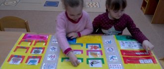
The sooner a geographical map appears in the baby's room, the better. Don’t think that your baby won’t understand or remember anything. It is enough just to draw the young geographer’s attention to the map from time to time, show and name geographical objects, and very soon the child will know parts of the world, oceans, and even many countries with their capitals.
And diverse children's literature is a real treasury of geographical knowledge. And the more we read to the baby, the broader his ideas about the world around him will be. And not just read, but definitely look on the map for the places where events take place. For such games, it is most convenient if the card hangs directly above the child's bed. So, reading about Carlson’s antics, let’s find the country of Sweden and remember its capital - Stockholm. Getting acquainted with the book about the onion boy Cipollino, we will find on the map his homeland - Italy. We’ll also find out where the mischievous Pippi visited during her sea voyages with her captain dad. Especially good is a children's map of the world with all sorts of biological, historical and fairy-tale object-icons. Kids love to look at them, at the same time memorizing a lot of useful information. But an ordinary physical map of the world or a map of the hemispheres will also work. And it’s easy to make a “developmental” card yourself from the most ordinary one. You can paste stickers and pictures with animals and fairy-tale characters onto images of continents. For example, we will place a sticker with the characters of the cartoon “Madagascar” near the island of the same name. And at the same time, we’ll find something interesting in the encyclopedia and read something interesting about this island with our kids. And let's not forget to follow the path of Marty the zebra and her friends from New York to Madagascar. If you find old magazines or atlases from which you can cut out flags of different states, stick them on the map along with the crumbs. Such games will bring undoubted benefits to the baby and will greatly facilitate further schooling.
Kipling's tales will perfectly acquaint the little geographer with the animal world of India. Let the baby remember the location on the map of this country. Travel across the map with Doctor Aibolit, who went to Africa to treat sick monkeys, and with Nils and a flock of geese. When the baby grows up a little, read him a fairy tale about the adventures of Captain Vrungel. It is simply replete with all sorts of geographical details. Of course, don’t forget to find on the map all the places where the brave captain visited on his famous yacht “Trouble”. Better yet, mark his path with a pencil directly on the map. In general, make it a rule to refer to the map in all cases when in everyday life we are talking about some geographical names, be it reading books, watching cartoons, or telling stories to friends who have returned from a trip. This will help the baby remember a lot of useful information and teach him how to use the map. And all this is practically effortless, as if by itself.
Norway
This Scandinavian Kingdom should also be noted with attention, telling interesting facts about different countries of the world.
In Norway, it is not customary to enter into dialogue with strangers while on public transport, even in a friendly manner and with a smile. This may be considered uncivil behavior. In general, the locals are very educated people. Norwegians are the most reading nation in the whole world, and the state itself is the safest and calmest in the whole world. Perhaps this is why many people want to move here. For example, in Oslo, 1/3 of the population are immigrants from developing countries.
This country is really spacious. Only 5 million people live there, which means there are only 16 people per 1 km². This sounds scary, but in the middle of the 14th century, the plague claimed the lives of more than 1/3 of the local population!
And here, until 995, when Christianity came to Norway, they worshiped the pagan gods Thor and Odin.
In the footsteps of Cecile Lupan
Many interesting geographical ideas can be gleaned from the book Believe in Your Child by Cecile Lupan. First of all, these are songs with the names of state capitals. You can tell your baby rhymes or sing songs that mention geographical names. After all, in poetry such information is remembered much easier. Here are some examples:
We soar over Italy, We see the eternal city of Rome. And in Spain - Madrid stands in the center of the entire country. Here in France, in Paris, the Tower of all buildings is taller! And in Britain, without a doubt, London is the most important city.
It would be great to read with your child A. Usachev’s wonderful book “My First Geographical Discoveries”, where geography is studied in poetry and is very fun:
There are many islands in the world, So many that you can’t count them... But we can count six large continents: Africa, America (North and South), Australia, Eurasia, Antarctica (Blizzard). What is Eurasia? This is Europe plus Asia: The largest continent arose from two parts of the world!
Colored seas
Your little one probably already knows that rivers, lakes, seas and oceans are indicated in blue on the map. You can start getting acquainted with the planet’s water resources with the “colored” seas. The kid will be interested to know that on our planet there is a Black, Red, White and even a Yellow Sea. Find them on the map and try together to figure out why these seas have such unusual names. The Yellow Sea has a yellowish tint. The Red Sea is home to special algae. During periods of their intensive growth, it seems that the blue water surface is painted in red-brown tones. The White North Sea really has a very light, almost white color of water. And the Black Sea has long been nicknamed this because of the restless nature and black color of the water during storms and storms.
Or maybe the baby will want to draw these colored seas? What countries are they located near? What kind of people live there? Perhaps your baby has already visited one of these seas (for example, the Black or Red) or you are about to go on a trip. Then he will be doubly interested in learning more about these amazing seas.
And then find it on the map and look at other seas. And also try to understand the origin of their names. This will not only expand the child’s geographical knowledge, but also train his thinking, ingenuity and imagination. After all, you can put forward fantastic versions. And then, together with your mother, find information in a children's encyclopedia or on the Internet and check your guesses. After all, why the Mediterranean Sea was called that way, the child will probably guess for himself. You just need to look carefully at the map. The Sea of Japan and South China Sea, for example, will not cause any difficulties. But you will have to think about the origin of the name of the Dead Sea.
Hungary
Few people know that it was in this country that the ballpoint pen, Rubik's cube, and dishes such as goulash and salami were invented. And here is the largest lake in all of Central Europe - Balaton. Locals call it the Hungarian Sea. And it is in Hungary that the world's largest thermal lake is located. It's called Heviz.
It is also worth noting that Budapest, the capital of the country, has the world's longest tram. Its length exceeds 50 meters! And the trains used in the metro were manufactured in Russia (in Mytishchi).
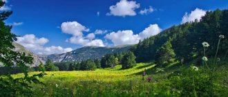
Geography on a walk
Where is the best place to study Earth Science?
On a walk, of course. Better yet, organize a real scientific expedition with your child. To do this, it is not at all necessary to go on a multi-day hike. Just on one sunny fine day, tell your child that today you are not just going for a walk. You are going on a journey. What do you need for a real trip? Comfortable clothes and shoes, a backpack and, of course, something tasty to refresh yourself at the rest stop. Ready? Then let's go! It doesn’t really matter where you go with your young traveler: to the forest, park, to the river or to the pond. Just draw his attention to the world around him and tell, tell, tell. For example, about soil. What is black soil, how is it formed and what plants grow on it. Use a stick to rake the pine needles in the pine forest, and let the child see with his own eyes that pine trees grow on sand. What is sand anyway? What about clay, granite, marble?
Be sure to take a compass with you on your mini-hike. Such a wonderful attribute will give the trip special significance. In addition, this is an excellent opportunity to introduce your child to parts of the world and tell them about the wonderful guiding arrow. Probably the baby already knows that in the morning the sun rises into the sky in the east, and in the evening it sets on the other side - in the west. Could the sun mess up something and rise in the west? Of course not. After all, the Earth rotates only in one direction. By the way, have you watched the sunrise and sunset with your child? Does he already know what the horizon line is?
Teach your child to use a compass. Let him hold the compass in his hands and slowly rotate around himself until the red arrow points to the letter N (north). Explain to your child that he is now facing north. Behind him is the south, on the left is the west, on the right is the east. Let the baby determine along the way in which direction you are moving.
You can play the game “I know 5 names...” right on the go. Mom asks the topic: “I know 5 cities...”. And the kid continues, listing the names of cities known to him at each step: “Moscow - one, Kyiv - two...”. Topics can be very different: countries, capitals, seas, rivers, lakes, peaks, volcanoes. Or even like this: “I know 5 animals living in North America...” If 5 names are easy to remember, we name 10 at once. Mom prompts, the baby remembers. This is how we expand our geographical knowledge.
During a walk in the forest, bury a “treasure” in a secluded place - a tightly screwed glass jar with children’s “treasures”. Draw a map of the place where your treasure is buried, using symbols. Usually children are delighted with such games. Save your map carefully and during your next walk try to find the cache using it as your guide. Come up with your own designations for deciduous and coniferous trees, bushes, stumps, large stones, ravine, lake, spring, rivulet. And then, already at home, look with your child at how the same objects are indicated on real maps. The game can be continued endlessly, drawing a map of a room, apartment, yard, street, and even made-up maps of imaginary countries and islands. Such games not only expand geographical knowledge, but also train the spatial thinking of the young cartographer and treasure hunter.
When talking with your child about such difficult things as the structure of the Earth, take into account the child’s ability to understand everything literally. One day, during a walk, a five-year-old daughter thoughtfully examined a crane visible from behind the fence of a construction site. The crane was lifting concrete slabs. “Are those slabs in the ground the same as these?” I didn’t immediately understand what it was about. What slabs are in the ground? “Well, those that collide with each other and create an earthquake.” These are the times! Having once read in a children's encyclopedia that earthquakes occur from the collision of large masses of earth (plates), my daughter decided that these were concrete building slabs lying in the ground and colliding from time to time, apparently out of boredom. She just hadn’t seen any other slabs in her life and couldn’t imagine what it was. So, when explaining such complex things to kids, try to find out from them how they understood your (or book) explanation. Otherwise, confusion in children's heads cannot be avoided.
About education
Finally, I would like to talk about schools in different countries of the world. Interesting facts can sometimes even shock you. For example, students in educational institutions located in Papua New Guinea do not have to wear clothes.
In some Indian towns, the situation with education is so sad that schoolchildren are taught... by children just like them. There is such a school in the city of Murshidad. The teachers there are taught by children who acquired their knowledge from outside. In general, in India, parents are very worried about the success of their children. So if a tourist sees people climbing on window bars, you shouldn’t be surprised - these are adults trying to tell their children the correct answers to exam questions so that they pass everything successfully. It is prestigious to get an education here.
In different countries of the world, interesting facts characterize this or that state in their own way. The economic situation in Indonesia is very sad - everyone knows this. In the village of Levak, for example, there is only one school, and to get to it, you need to overcome a dangerous suspension bridge, which at any moment can fall into the river.
In some settlements in the Philippines, children get to school by crossing bodies of water in inflatable boats. And in Colombia, students cross the Rio Negro River, sliding down a 400-meter cable to the opposite side of the bank, since there is a school there.
However, there are still many interesting facts about the states of our world, and if you wish, you can familiarize yourself with them. Because it’s very difficult to list everything.
Expeditions with Winnie the Pooh
For kids with their developed imagination and wild imagination, any event that seems insignificant in our opinion can become a geographical adventure. Remember how Christopher Robin, along with his friends Winnie the Pooh, Piglet, Donkey and Rabbit, went on an expedition to find and discover the North Pole?
Our entire expedition wandered through the forest all day. The expedition was looking everywhere for the way to the Pole...
But you too can go in search of the pole. And not only the North, but also the South too. Just first show your child these poles on the globe and tell him about the earth's axis - an invented line that seems to pierce the Earth right through. Those points through which our imaginary axis passes are called poles. The upper pole is called the North Pole, and the lower pole is called the South Pole. The poles receive the least amount of solar heat, which is why the coldest places on our planet are located here. Of course, the search for the pole will be imaginary, and no earthly axis actually exists. But while walking, you can discuss many important and interesting things: what is called the Arctic and what is the Antarctic, which animal lives at which pole, what is the polar day and polar night, what are winter and summer like at the poles, what are icebergs, what are they for? icebreakers are needed to study polar expeditions and much more.
And next time you can go in search of the equator. And, of course, talk about the fact that the equator is also an invented line. It’s as if it surrounds our Earth with a belt in the middle. This is where the sun's rays get the most, which means it's always hot at the equator. There is no winter here. Let's remember the hot equatorial countries and their inhabitants, sandy deserts and dense jungles, tropical rains and drought, and of course the amazing animals that live here.
Luxembourg
When listing interesting facts about the countries of the world for children, it is worth mentioning the Grand Duchy. The only thing in the world and.
This is one of the smallest states in the whole world. Its area is only 2,600 km², and about half a million people live on its territory. But it is Luxembourg that ranks 3rd among EU countries in terms of business efficiency. The first and second lines of the ranking are occupied by Finland and Denmark.
It also has the highest minimum wage in the whole world. At the moment it is 1,642 euros (about 113,000 rubles). And the figure is constantly growing! And the GDP in Luxembourg is the highest - three times higher than the European average. There is also an amazing literacy rate (100 percent!) and education, which is one of the best in the world. After such a list of facts, it will not be surprising that the whole of Luxembourg is included in the UNESCO World Heritage List.
Minerals
Our land contains many real riches and treasures. And this is also an interesting and important topic for discussion with your child. Why are natural resources called “minerals”? Fossils - because these riches need to be sought and dug out of the ground, and useful ones - because they bring great benefits to people. While preparing dinner with your little one, tell him about natural gas. But in the kitchen there is another valuable “fossil” - salt. Ceramic dishes are made from clay, glass from sand. All these are minerals.
Sitting by a fire in the forest, think about coal; when traveling in a car, think about oil. Walking around the city will introduce your baby to rocks such as marble and granite. They are widely used in construction. While doing creative work with your little one, tell them that earthly riches even help them make wonderful drawings. Multi-colored crayons for drawing on asphalt are a type of chalk rock. It was made from shells and parts of tiny plants and animals that lived many, many years ago. And the lead of a pencil, which leaves colored lines on paper, is made from a mineral called graphite.
Rings and beads are made of precious stones. These stones are very beautiful. They shine and shimmer in different colors. Such stones are rare in the ground and are expensive, which is why they are called precious. These are diamonds, rubies, emeralds, etc.
Try creating your own collection of minerals with your child. Most likely, you will not be able to find precious stones, but ordinary salt, coal, sand, chalk, graphite, etc. will rightfully take their rightful place in it.
Conditions for classes
In order for geography classes to be successful, it is necessary to take into account the child’s characteristics:
- fatigue;
- heightened sense of self-esteem (at a certain age);
- interest in acquiring knowledge through play;
- the need for your encouragement (verbal).
Based on this, we can conclude about the peculiarities of conducting classes:
- lessons should be short (5-10 minutes);
- you need to trust the child without checking how he has acquired knowledge;
- the lesson should be prepared in advance and interesting, take place in a playful way, with bright, visual materials on geography;
- Praise your child for his interest in activities.
The child needs to be interested in what is being told to him. Geography is an unfamiliar subject for two-year-old children, so you shouldn’t expect specific questions on a variety of topics on the subject.
You can pick up on a third-party question that interests you and develop the topic in the direction you need. Questions should arise from the child after becoming acquainted with a new phenomenon or previously unknown object that captured his imagination.
Watching nature programs on TV is not the best way to introduce geography to a one and a half year old child. In this case, you are more likely to introduce him to the TV.
It’s better to take him to nature, where there is a varied landscape, a river flows or fields lie. Let him feel the beauty that surrounds him, see the blue sky, the distant horizon. Tell your child that there are other countries far beyond the horizon. That getting there is not at all as easy as it seems.
The child will become familiar with many concepts of physical geography after such a walk. For children four years old and older there are interesting series of cartoons: “Geography for Kids”, “Why”, etc.